


Does it sometimes seem like every single inch of Earth has been discovered? Far from it. But scientists are working on it.

11 Unexplored Places on Earth That Still Haven’t Been Mapped


Updated on May 29, 2025
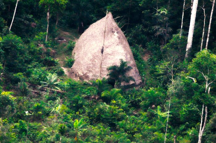
Vale do Javari, Brazil
Called one of the most isolated parts of the world, as many as 19 uncontacted Amazon tribes make their home in this region. It comprises an area about the size of Austria—or 33,000 square miles. In 2022, the British journalist Dom Phillips and the Brazilian activist Bruno Pereira were murdered in the Amazon for trying to protect the area.
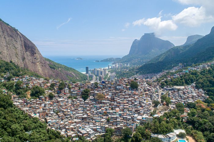
Slums
Look at a map of a city and you’ll find streets and parks and highways and buildings all clearly indicated. But in some cities, that clarity is just an illusion, at least in part. In cities like Rio de Janeiro, Brazil and Lagos, Nigeria, slums are often not delineated on maps. Why is this important? According to a 2022 article published in the journal Remote Sensing, policymakers need maps of slums to make informed decisions about infrastructure development and allocation of aid across different settlements.
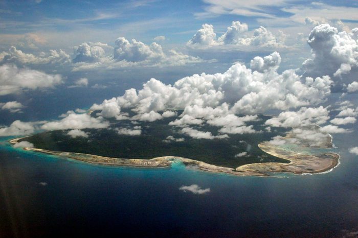
Sandy Island, South Pacific
Some places that do exist don’t show up on maps, while other places that don’t exist do. One recent example is Sandy Island, which used to appear on marine charts and world maps, as well as on Google Earth and Google Maps. But when scientists set out to study the island that’s supposed to be located between Australia and New Caledonia, they discovered it isn’t there, and possibly never was, BBC News reports. Human error, repeated down the years, is thought to be at fault—although it’s also possible that the island came…then went.
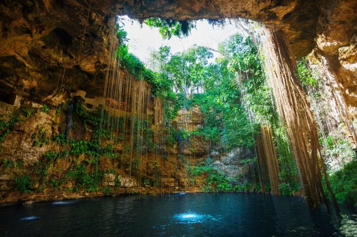
Yucatan Cenotes
This underwater cave system on Mexico’s Yucatan peninsula, thousands of kilometers long, has remained largely unexplored since the time of the Mayans, and exists on no maps, according to photographer Klaus Thymann. He’s both begun to explore and photograph it in order to bring awareness that will lead to its conservation, he told The Guardian. The rivers that run through the system “form the aquifer of Yucatán and support about 11 different ecosystems.”
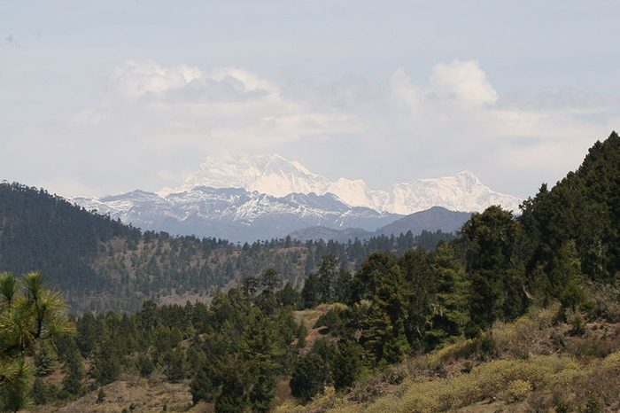
Gangkhar Puensum
It’s probably the highest unclimbed mountain in the world, although some people have tried to scale this 10,000-foot peak in Bhutan. Like many tall mountains, this one is unmapped—although unlike other mountains, it remains uncharted for spiritual reasons. To locals some areas in the mountains are the refuge of centuries-old buddhist saints and mountains themselves homes to gods and goddesses. Although climbers hoping to scale tall peaks like this one could use Google Earth to get an idea of what they’re in for, many consider that cheating.
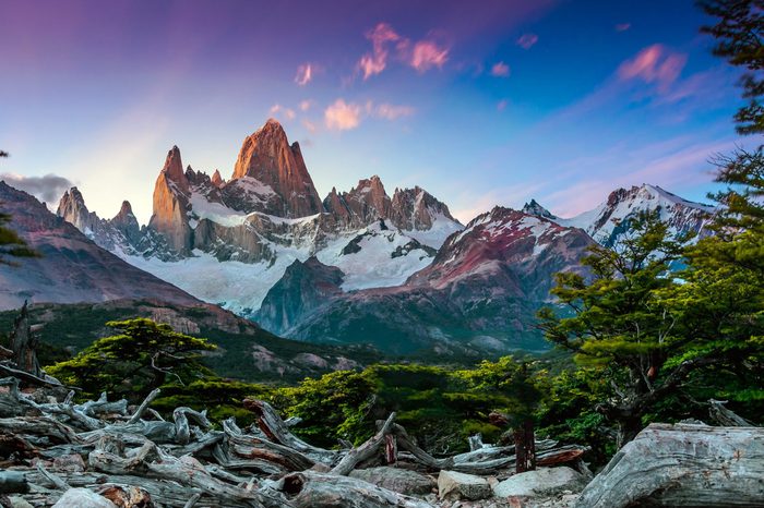
Patagonia, Argentina and Chile
According to Geospatial World, the Patagonia region stretches almost all the way to the South Pole and is dotted with rainforests and glaciers so remote and hostile that they’re virtually impossible to chart. “With ice fields comparable to those in the polar regions, this is a difficult and dangerous task,” the article’s author, Lucy Harris, writes.
Northern Forest Complex, Myanmar
Years of economic sanctions against this Southeast Asian country may have helped protect some of its pristine forest from development. But that seems to be changing, with forests steadily disappearing and with it, many vulnerable species. It’s difficult to gauge the damage, though, because with of the lack of roads in these areas, few people can get in to assess what’s going on. That means the forest is likely disappearing before it can even be adequately mapped.
Cape Melville, Australia
The “lost world” of Cape Melville is an Australian headland that’s been cut off from exploration by a surrounding wall made of boulders of granite that are hundreds of feet tall. While they’ve effectively protected its internal rainforest habitat, it also means the area is virtually impossible to map.
North Sentinel Island, India
Because of a local population that reportedly isn’t keen on visits from outsiders, North Sentinel Island, part of the Andaman Island archipelago off the southerly tip of Myanmar, remains—and probably will remain for some time—unexplored (by non-Sentinelese) as well as unmapped.
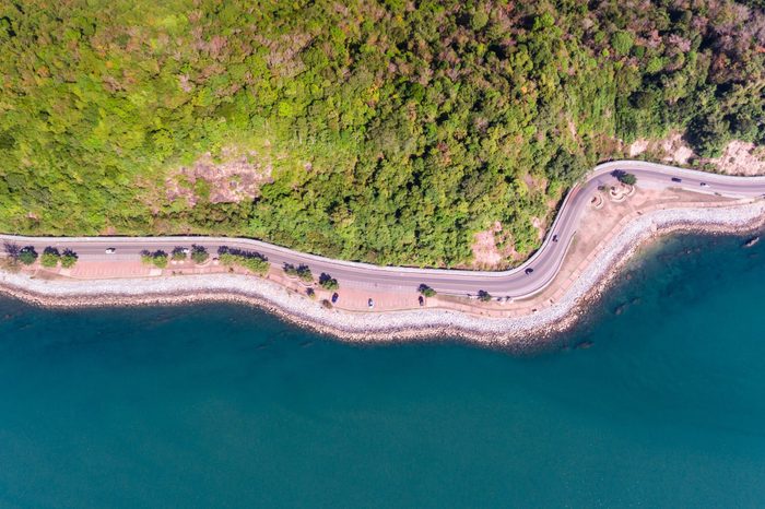
Coastlines
Even in places where we’ve had accurate maps for decades, climate change—which is causing rising sea levels, intense storms, flooding and all the erosion those events engender—is actually changing the lay of the coastal land as we once knew it. Can our map makers keep up with the rapid-fire changes?
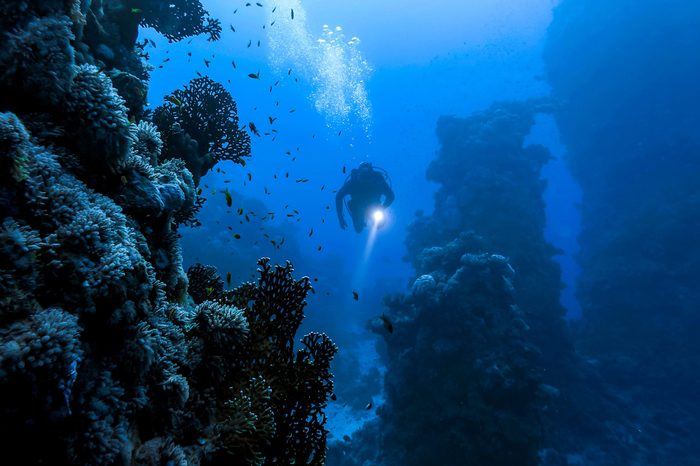
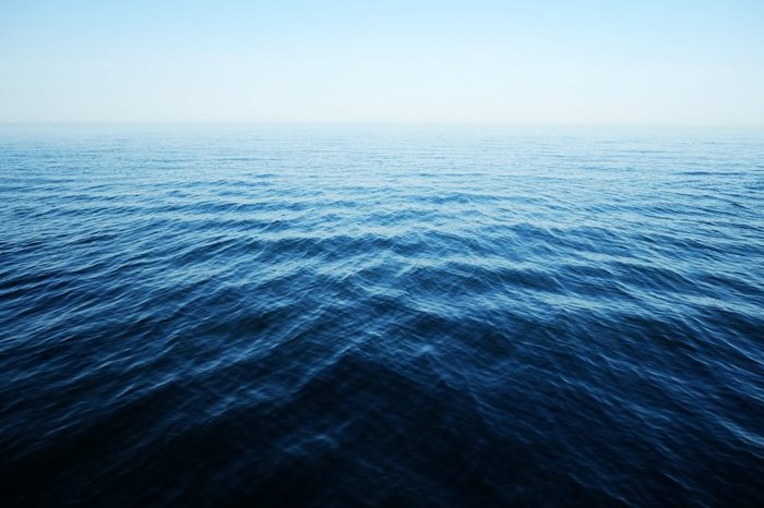
The ocean floor
It’s vast—our planet’s five ocean basins cover 71 percent of the earth’s surface. And although we actually have mapped it, that map is distinctly low-res, as only 23% has been rendered in great detail, according to National Oceanic and Atmospheric Administration (NOAA). In fact, it’s less detailed, even, than our maps of Mars, the Moon and Venus. That’s because all of that pesky water gets in the way of mapping tools. But… oceanographers are working on it.
Why trust us
At Reader’s Digest, we’re committed to producing high-quality content by writers with expertise and experience in their field in consultation with relevant, qualified experts. We rely on reputable primary sources, including government and professional organizations and academic institutions as well as our writers’ personal experiences where appropriate. We verify all facts and data, back them with credible sourcing and revisit them over time to ensure they remain accurate and up to date. Read more about our team, our contributors and our editorial policies.
Sources:
- Missing Maps: “About Missing Maps”
- The Guardian: “Javari valley: the lawless primal wilderness where Dom Phillips went missing”
- The Guardian: “‘We carry on with the sadness’: new projects honor life and legacy of Dom Phillips and Bruno Pereira’
- Remote Sensing: “Uncertainty-Aware Interpretable Deep Learning for Slum Mapping and Monitoring”
- BBC News: “South Pacific Sandy Island ‘proven not to exist’
- The Guardian: “’Swimming into the unknown:’ Mexico’s unmapped underwater caves – in pictures
- Times of India: “An insight into the legend of the tallest ‘unclimbed’ mountain in the world”
- Geospatial World: “Where are the World’s Uncharted Corners?”
- Dialogue Earth: “Interview: Myanmar insurgent groups key to forest and climate protection”
- Forbes: “Everything We Know About The Isolated Sentinelese People Of North Sentinel Island”
- National Geographic: “Erosion”